The North Coast
For this tour you need a car or bicycle and it takes you along the beautiful coastal road north towards Glommen and then back via the villages closest to Falkenberg.
You will experience interesting destinations and a lot of beautiful nature. Along the Glommen coastal road there are also several nice beaches for swimming.
Distance: 55+15 km
Tip: Remember that several of the destinations along this tour have varying opening times, so check beforehand that the places you would like to visit are open.
FROM FALKENBERG TOURIST INFORMATION OFFICE drive past Stortorget and follow Holgersgatan straight on to the bus station that until 2008 used to be the railway station in Falkenberg.
The station house was inaugurated with pomp and circumstance in 1886 by King Oscar II
Turn left by Falkenberg church, built in the neo-Gothic style from granite, sourced in Halland.
It was drafted by Adrian C Peterson, one of the most acclaimed church architects at the time and was consecrated in 1892.
Turn right (into Nygatan) and drive straight through the roundabout.
In the roundabout is the outdoor art work “Farled” (Waterway), made by Åsa Herrgård in 2004. It is part of the hull of a ship, but also a portal to the town.
Drive north on the coastal road towards Glommen. The bicycle path “Kattegattleden” follows the coastal road towards Varberg. At the four-legged intersection, continue straight on. 400 m after this crossing you see a sign towards “Lövstaviken”.
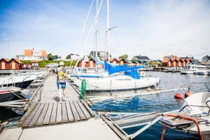
Here is Lövstaviken marina and guest harbour, which make a nice stop. Along the coast you will find several nice, both little and large, beaches for swimming.
Continue along the coastal road about 5.5 km north towards Olofsbo seaside resort. By the sign “Olofsbo Havsbad” turn left. Drive all the way down to the dunes and park.
By the parking lot is a picnic area and a toilet.
1.Olofsbo havsbad
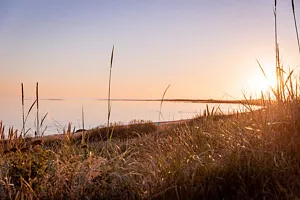
The beach at Olofsbo is a long, nice and child friendly sandy and shallow beach. Take a dip in the sea and enjoy an ice cream. There is also a designated part of the beach where dogs are allowed.
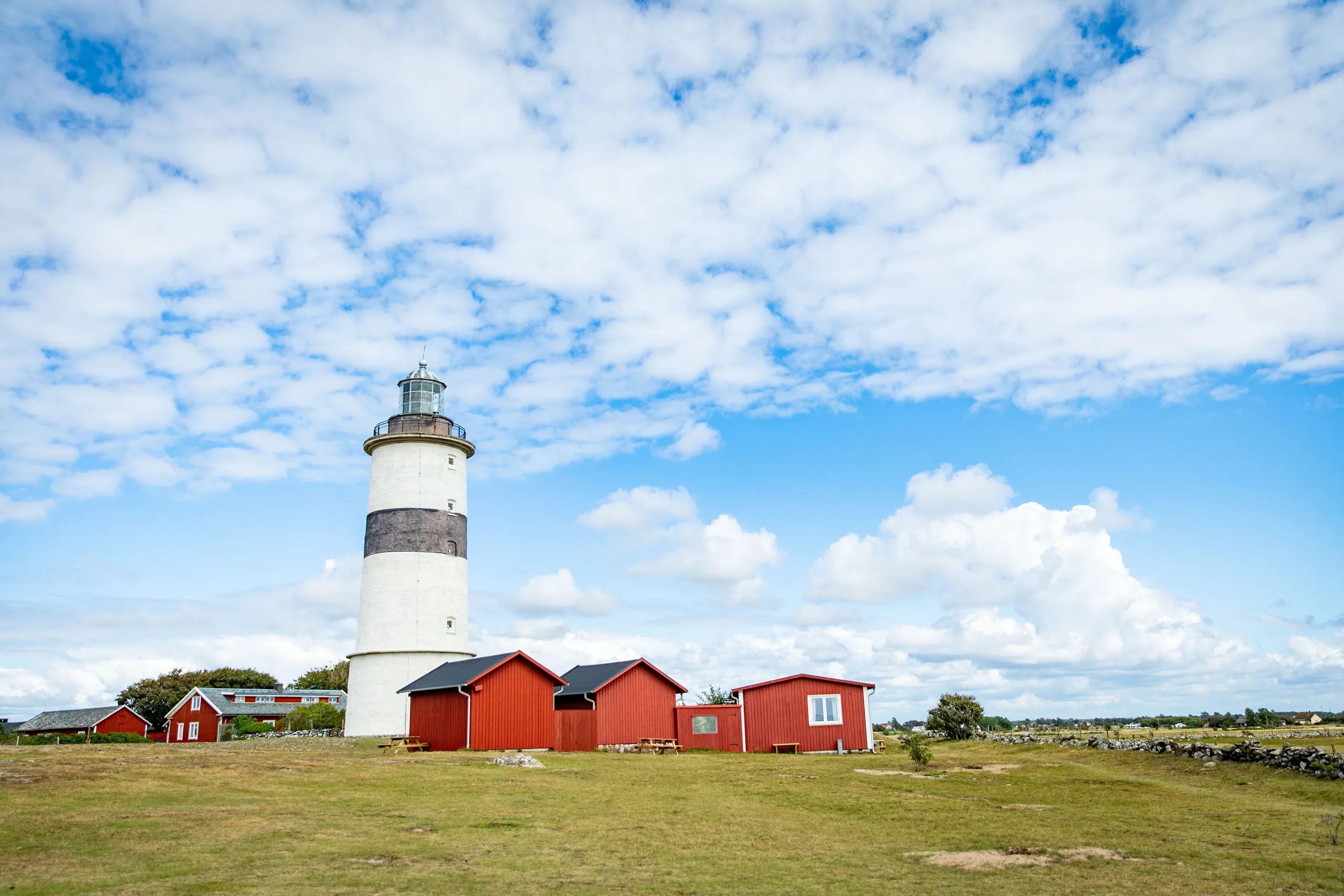
Drive the same way (Mastvägen) back to where you turned off, take a left out onto the coastal road again. After 1 km, turn left towards Morups Tånge naturreservat (nature reserve). Follow the tarmac road for 1.5 km. Then take a left onto the gravel road. Open and close the gate behind you. There is parking, a picnic area and a toilet close to the lighthouse.
2.Morups Tånge – nature reserve and lighthouse
Morups Tånge is one of the most precious bird sanctuaries in Sweden. Already at the end of the 1940s the area was declared a bird sanctuary. During the spring and autumn many different kinds of birds pass through on their migratory path, north and south respectively. Morups Tånge is a well-known place, particularly to spot resting wading birds. Read more about other interesting species of birds in the reserve on the information board. The beach meadows have been used for grazing for centuries.
Morups Tånge as a lighthouse station is very old. Already at the end of the 16th century the name “Murup Tynge” was marked on Dutch nautical charts. The present 28 m tall lighthouse was built in 1843. Wander around in the fabulous environment. Here anything can happen and no visit is the same as another. Note: There might be free roaming animals (cattle and horses) grazing in the nature reserve.
From the parking area, drive back to where the gravel road ends. Take a left and continue straight on until you see the sign “Hamnen” (harbour) and take a left. Follow the road straight on, then turn right into Båthusvägen. Follow Båthusvägen to Hamnvägen and turn right. At the T-junction take a left. Parking and toilets will be on your right. There is a picnic area by the boathouses and Glumstenen
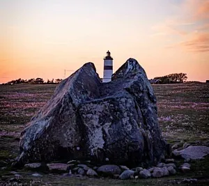
3.Glommen – An Idyllic Fishing Village
This is a well kept harbour with boathouses, nets and fishing vessel traffic. Glommen has a guest harbour. At the very end of the north side, in the old fishing village, is the ancient navigation mark Glumstenen.
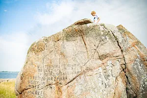
4. Glumstenen
This rock has been functioning as a landmark for maritime navigation and has also given the village its name. In Hakon Hakonsson’s saga about the war campaign in Halland in 1256 Glumsten is mentioned as the landing place and base for the ravages north and south of here. In 1816 Bexell had the water level at the time marked on the stone.
From the parking by Glumstenen, follow the Glumstensvägen through the village. You pass the fish restaurant Glommens Fiskekrog on the left and you soon arrive at Annies Stuga.
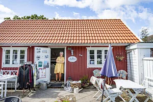
5. Annies Stuga
N: 56.930869180466324 E: 12.359026171708114
Annie’s Cottage is a cosy shop where you can buy interior design items and clothes. Here you are guaranteed to find something you want, because even if the shop isn’t big the range is massive. In the summer there is also a garden café.
Continue on the road appr. 100 m, to find Brännässlan to the right.
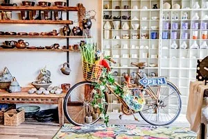
6. Brännässlan
N: 56.93045756385324 E: 12.360603458214715
Here you find a large range of pottery, both for everyday use and art works. Many have been inspired by the sea, like clam shells, fish and corals.
Continue to the roundabout and continue straight on towards Bölse. A little way on this road you find the farm shop Thuresson.
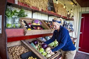
7. Gårdsbutik Thuresson
Here you have the opportunity to fill up your fridge with locally produced, high quality meats. The farm’s own marinades enhance the flavours of the meat and turn you into a barbeque champion. Here you can also get charcuteries and other delicacies. Read more at: www.gardsbutikthuresson.se
After the farm shop Thuresson, drive north. At the T-junction, turn left and drive towards Hule Trädgård.
8. Hule trädgård
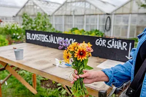
In the big greenhouse at Hule Trädgård garden centre flowers, vegetables, herbs and other good things grow. In the greenhouse you also find the farm shop where you can purchase all these good things. The apple press opens in September when you can get the lovely apple juice from the farm, or hand in your own apples for pressing. Read more at: www.huletradgard.se
Then continue on the same road until you reach a crossing, take a right and continue towards Morup.

9. Farmors lada Café och Kuriosa
(Grandma’s Barn Café and Curiosities)
Farmors Lada is rural and has a sea view in Morup. Here you can buy beautiful old things or sit down to have something nice in the café. The shop is open during summer. Other times you need to knock on the door. There is also a Bed & Breakfast in an old traditional Hallandian farmhouse from 1868. Read more at: www.farmorslada.se

10. Kronmakaren
In Morup there is a small studio that makes bridal crowns and hair jewellery from wire, with a shop, a showroom and a coffee bar. The studio is run by the wire artist Britten Toftarp and is open by appointment. Read more at: www.kronmakaren.se
By the T-junction in Morup turn right and then immediately left by the signs “Kyrka” and “Lanthandel”. After appr. 300 m, turn left again towards Tvååker.
Here you find Morup church. Parking is on the left side of the road.
11. Morups church
The church was built in the 13th or 14th century. It is one of few mediaeval red brick churches and is believed to have been built by cistercian monks from the Esrum monastry in Denmark. Because of the red brick the church was called “den röde kirke” (the red church) during the Danish era. It functioned as a navigation mark for sailors. At the beginning of the 19th century the church was extended to the east and a new tower was added. In 1804 the church was plastered white.
Turn back and take a left turn at the T-junction (by the school) and continue towards Långås. After appr. 700 m turn right at the sign “Krukmakeri”. Drive another 300 m and you will have arrived at the pottery Annas Krukor & Fat.
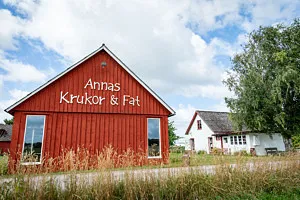
12. Ekomuseum – Annas krukor och fat
Since 1988 Anna Leandersson has had her own workshop. She works in both clay and stoneware, and makes mostly everyday usable pottery items. Read more at: www.annalea.se
Drive back and continue towards Långås. At the T-junction turn left towards Långås. After a little more than 2 km, take a right turn at the crossroads into the village of Långås. Follow the road to the roundabout and turn left towards Sibbarp. After a little more than 3.5 km, turn right towards “Hässlås” and “Kapell 1”. After 1km Hässlås chapel is on your left.
13. Hässlås Chapel
Hässlås’ wooden chapel was built as a private initiative 1927, using drafts by Arne Gustafsson.
Continue appr. 600 m. Take a left by the small white sign “Bengtesgårds äng” onto a gravel road. Drive a little more than 400 m and park by the parking sign. Walk appr. 100 m to the nature reserve.
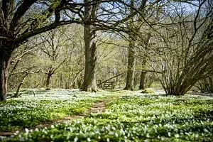
14. Bengtesgårds äng
Oak meadows with lots of hazel. The Bengtesgård meadows are one of the few preserved hayfields. In the middle of the 19th century hay-making stopped in favour of grazing. When the grazing then stopped after appr. a century the meadows became overgrown, but when the nature reserve was established the traditional maintenance was resumed in the east part of the reserve. A picnic area and toilet are available.
Drive back along the same road (past the chapel) to the T-junction. Turn right and continue towards Sibbarp. After 1.5 km, turn right towards Ljungby. Continue on this road appr. 3.5 km and enjoy the Hallandian rural landscape with its wide fields and pastures. By the sign “Vinberg 5”, turn right and follow the signs towards Vinberg (For the detour, turn left before the sign “Vinberg 5”).
DETOUR TO LJUNGSJÖN – APPR. 3 KM RETURN
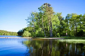
15. Ljungsjön
For those who fancy a swim, a barbeque or to hike along the lake, Ljungsjön is worth a little detour.
Just before the sign “Vinberg 5” turn left onto a gravel road by the horse event course. Drive 300 m and then turn left onto a tarmac road. Drive another 800 m and turn right at the sign “Badplats”. Follow the gravel road towards the bathing place.
By the lake Ljungsjön there is also a barbeque area, toilets and picnic benches. There is also a walking path around the lake that is appr. 4.5 km.
Drive the same way back. At the end of the gravel road (by the event course) take a left and then immediately right by the sign “Vinberg 5” and continue towards Vinberg. By Hällerup, turn left. Continue to the crossing and drive straight through, over road 154. Drive into the village of Vinberg and by the crossing turn right. After appr. 400 m turn left by the sign “Vinbergs kyrkby 2”. After 1.5 km you have reached the Vinberg church village. At the T-junction take a right towards Falkenberg. Then turn immediately left into a smaller road. Continue straight on until you see the parking sign.
16. Ekomuseum – Vinbergs Church and Surroundings
In the Vinberg church village is the best preserved neo-Gothic church in Halland. The church was consecrated in 1899. Here you can also wander around to see the church stables, the vicarage, the old church yard and the stone commemorating the author Olof von Dalin, who was born at the vicarage in Vinberg in 1708. The stone was erected on the initiative of the locals in 1957. Olof von Dalin wrote among other things “Sagan om Hästen” an allegory of the history of Sweden from Gustav Vasa to Fredric I.
After studying at the university of Lund he went to Stockholm where he became a central figure in the cultural sphere. In 1750 he became the governor of the crown prince who was to become Gustav III. He was knighted von Dalin and was at his time of death 1763 chancellor of the court, i e one of the most powerful public servants of the land. Read more at: www.ekomuseum.com
Continue towards Falkenberg. Turn towards Stafsinge straight after the bridge crossing the motorway E6/E20. Drive on to road 154 and at the roundabout, drive straight on.
On your right hand side is where the first church in Stafsinge was located between the 12th century until the year 1863.
Follow the road to the roundabout and continue straight on. Continue to the signpost “Stafsinge kyrka”.
The current church was built 1862-1865 in the neo-Classical style. The white plastered church has a beautiful patterned slate roof. In the church a crucifix from the 15th century is kept. According to the lore the first church is supposed to have been built by the brothers Staffan and Inge, whose combined names made up the name for the parish.
Continue the road towards Falkenberg for almost 1 km. At a small T-junction, turn left and then straight on at the roundabout. Follow Arvidstorpsvägen down the hill and then take a left in the roundabout and you are soon back at the Falkenberg Tourist Information Office.
Have a continued lovely stay in Falkenberg!
A number of destinations along this self-guided tour are signposted with white signs saying “Ekomuseum”. Ekomuseum Nedre Ätradalen (Ecomuseums in the nether Ätra-valley) consists of a large number of destinations that aspire to provide a holistic experience of life and landscape in the valley of the river Ätran. For more information, see the Ecomuseum brochure that you can get at the Falkenberg Tourist Information. Also, see www.ekomuseum.com